
Daniel Salzler No. 1366 EnviroInsight.org Six Items July 10 2026
—————Feel Free To Pass This Along To Others——————
If your watershed is doing something you would like others to know about, or you know
of something others can benefit from, let me know and I will place it in this Information .
If you want to be removed from the distribution list, please let me know.
Please note that all meetings listed are open.
Enhance your viewing by downloading the pdf file to view photos, etc.
The attached is all about improving life in the watershed through knowledge.
If you want to be removed from the distribution list,
please let me know. Please note that all meetings listed are open.
Check our website at EnviroInsight.org
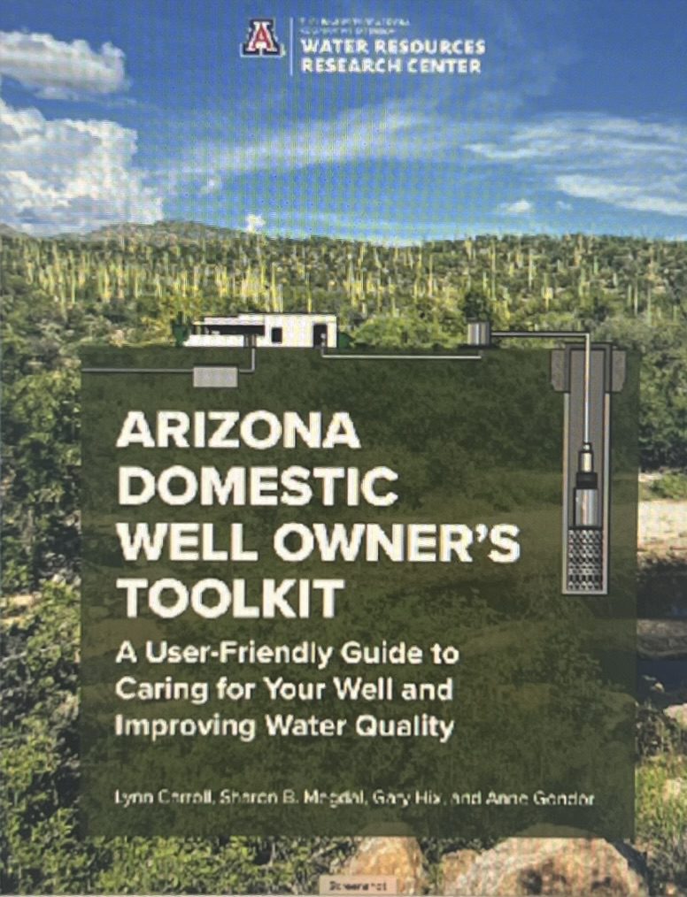
1. The Arizona Domestic Well Owner’s Toolkit was written to assist well owners in learning more about their drinking water. It is estimated that 13% of the US population gets their household water from self-supplied sources. In Arizona, it is estimated that 330,000 residents get their water from what are called domestic wells, which are registered with the Arizona Department of Water Resources (ADWR). For the domestic well owner, knowledge of the vulnerability of their well, the importance of water quality monitoring, and appropriate well maintenance is necessary to assure drinking water availability and sustainable supply into the future.
Topics covered:
Looking Towards the Future
Aquifers
Well Installation and Permitting
Well Operation and Maintenance
What Is in Groundwater?
State and Federal Law and Regulation
Testing Well Water Quality
Water Treatment Options
Protecting Your Well Water Quality
ARIZONA DOMESTIC WELL OWNER’S TOOLKIT
2. CLIMAS: June 2026 Climate Outlook. The Southwest Climate Outlook is published by the Climate Assessment for the Southwest (CLIMAS), with support from University of Arizona Cooperative Extension, and the New Mexico State Climate office.
Precipitation and Temperature
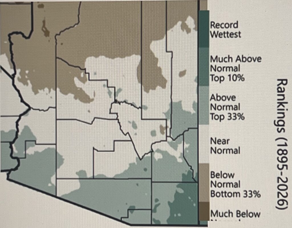
Southwest Precipitation – May 2026
Percentile
May precipitation totals were above normal across southern parts of Arizona ranging to near normal and below normal in the northern parts of the region.
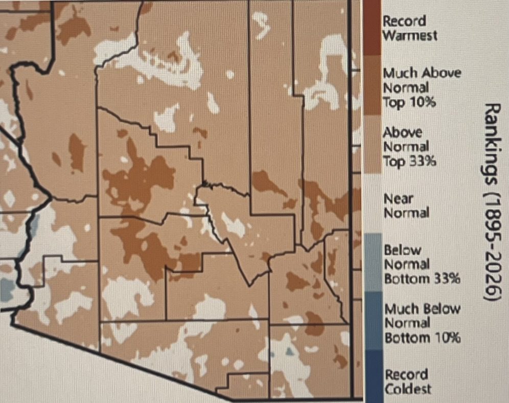
Southwest MeanTemperature- May 2026
Percentile
May temperatures were above normal across Arizona.
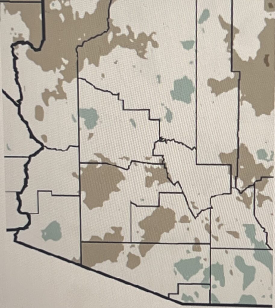
Southwest Precipitation Oct 2025 to May 2026 Percentile
Precipitation totals for the water year so far (October 2025–May 2026) are near normal for much of Arizona.Totals are above normal for some scattered areas across Arizona.
Drought
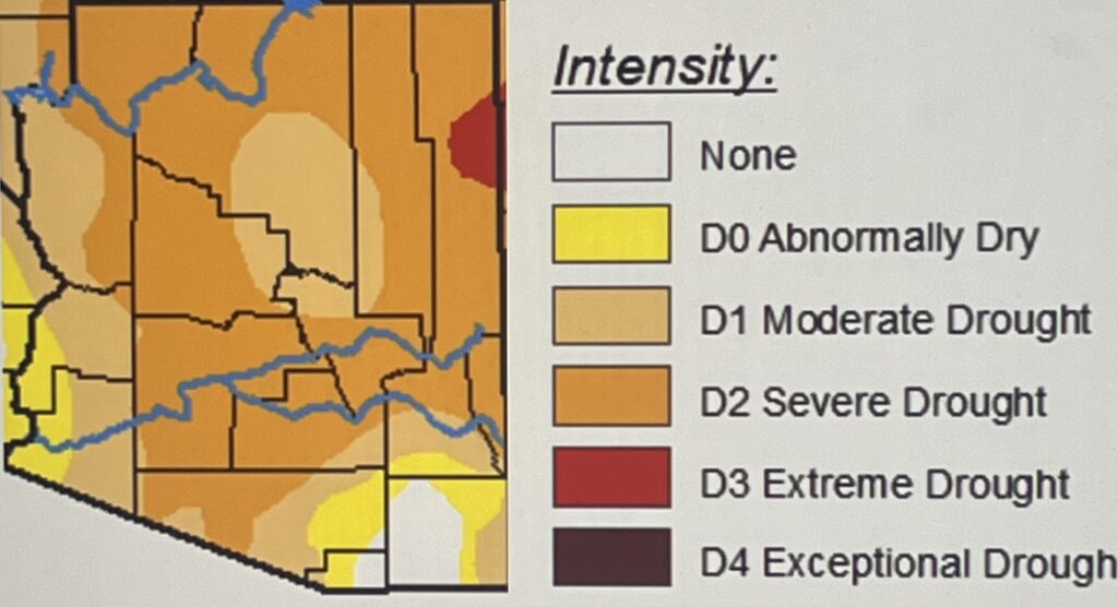
Drought conditions classified Severe (D2) or worse are extensive across the region, affecting 62% of Arizona. Extreme (D3) drought conditions extend into Apache County, Arizona. Only a few areas are not considered Abnormally Dry or in drought—parts of Cochise and Santa Cruz counties in Arizona.
Snowpack and Streamflow
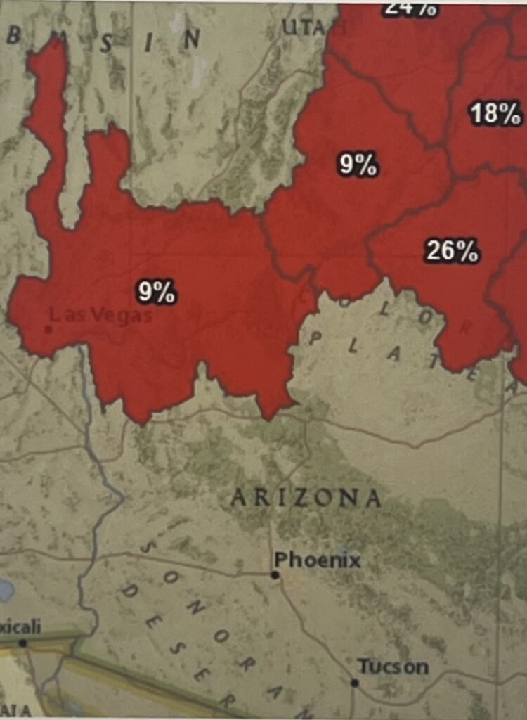
Streamflow forecasts based on June 1 hydrological conditions indicate very low expected flow volumes for stream basins that would normally be entering peak flow this time of year—21% of normal volume aggregated across tributaries of the Upper Colorado River Basin.
Water Supply
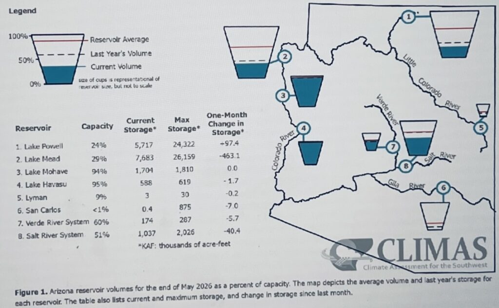
Reservoir storage in Arizona is generally below normal levels and down compared to last year, especially at San Carlos, where the effects of long-term drought on the Gila River watershed have left the reservoir nearly dry. Verde River storage is an exception, with levels near normal. Colorado River storage remains in decline—drought conditions in the Upper Colorado River Basin have resulted in a failure of any rebound in storage this year at Lake Powell and Lake Mead.
Seasonal Forecasts
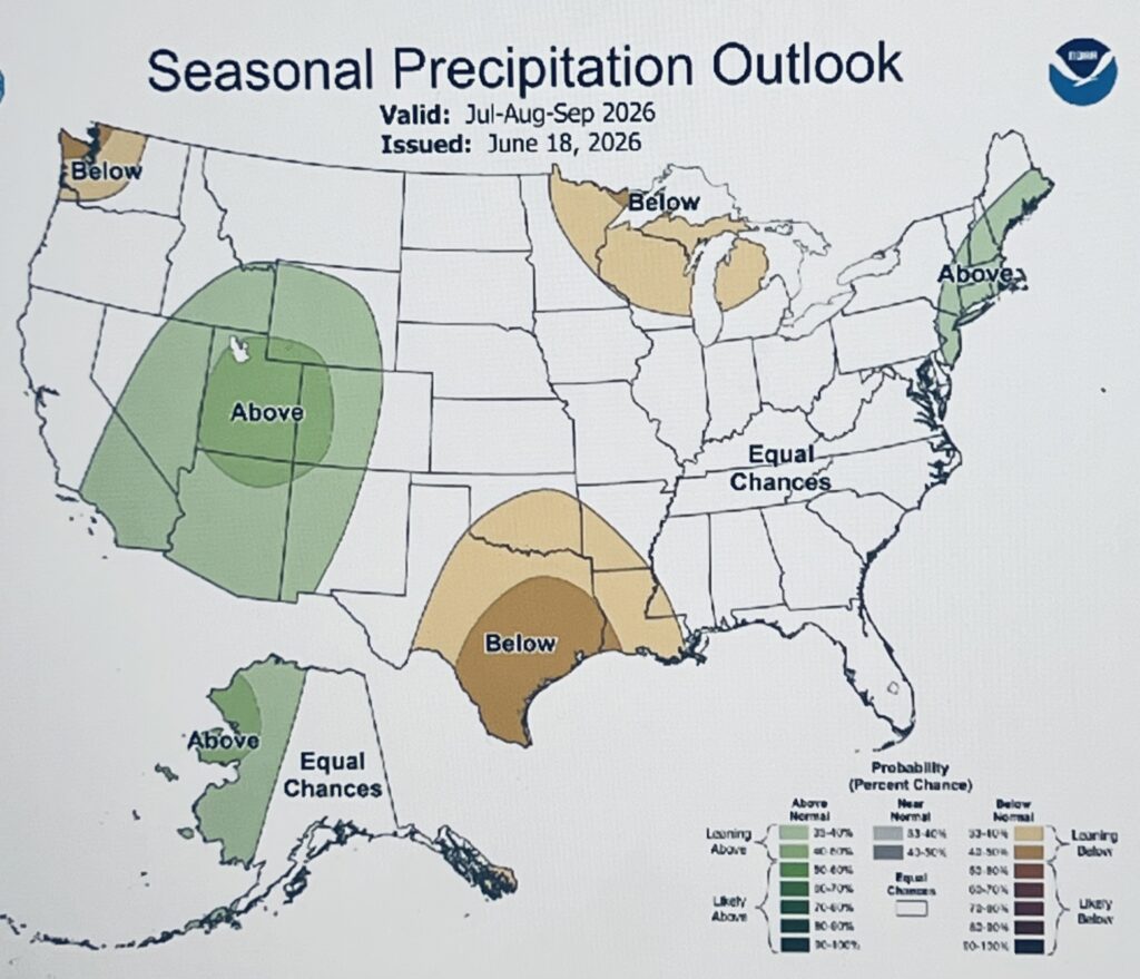
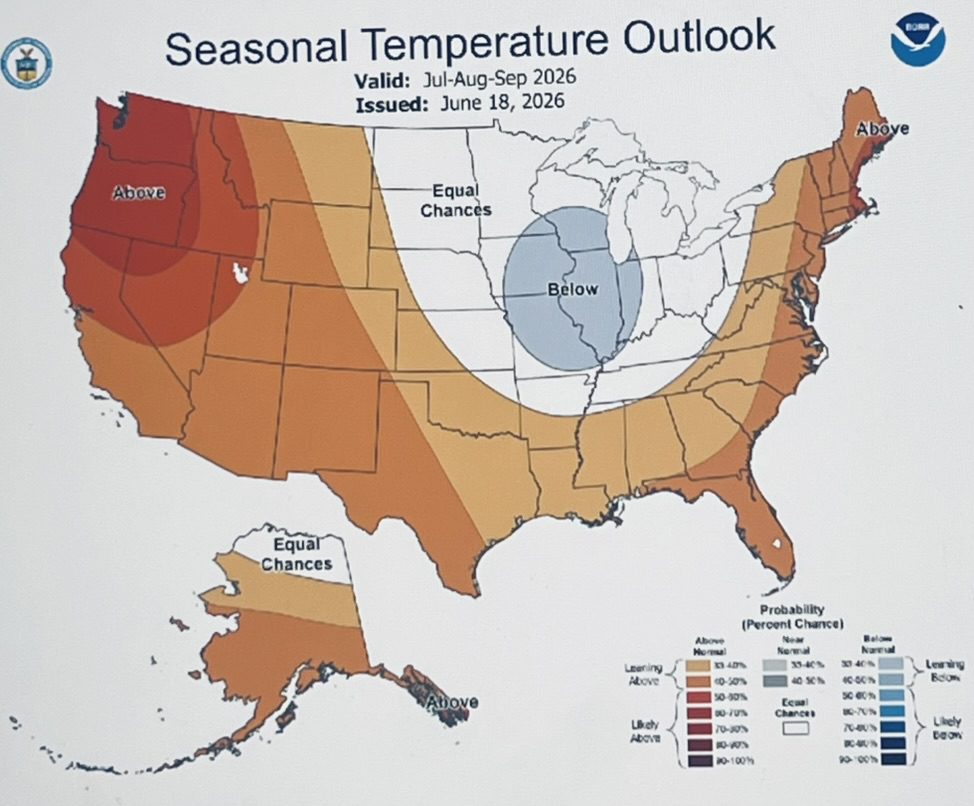
The July–September seasonal precipitation forecast leans toward above normal precipitation totals for an area that includes Arizona and much of New Mexico. This expectation is based in part on a likely enhanced moisture supply from the anomalously warm Eastern Pacific, including a potential increase in tropical storms.
3. Arizona Tries To Steer Away From ‘Extremely Draconian’ Colorado River Water Cuts. Source: KJZZ June 30, 2026
Arizona’s top water negotiator is working behind the scenes to avoid “extremely draconian” cuts to the state’s share of the Colorado River. It’s an eleventh-hour effort to work with the federal government, which is expected to release new rules for managing water in late July.
Tom Buschatzke, director of the Arizona Department of Water Resources, briefed the public on the process of negotiations and the state’s plans to adapt to water cutbacks.
The seven states that use the Colorado River have been under pressure to agree on new rules for managing its water, but have been at an impasse for more than a year. Absent that agreement, the federal government will impose its own rules for sharing water when the current ones expire later this year.
A draft of those rules imposed huge cutbacks on the Central Arizona Project, which brings Colorado River water to the Phoenix and Tucson areas. The three states that make up the river’s Lower Basin — Arizona, California and Nevada, countered with a proposal to voluntarily cut back on water use and avoid harsher, mandatory cuts from the federal government.
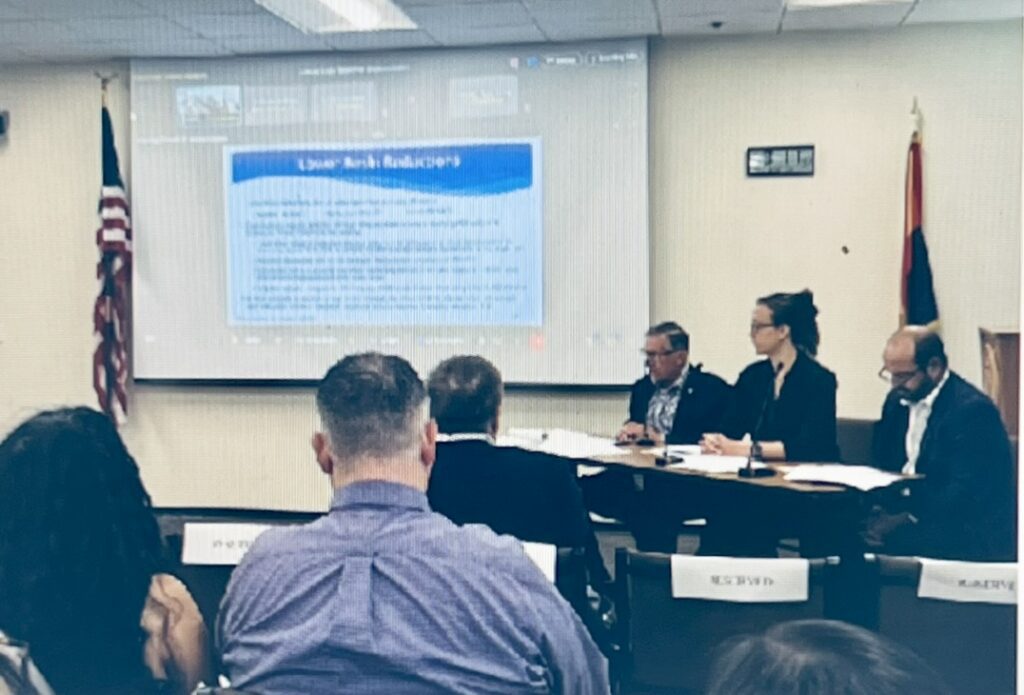
Now, Buschatzke is trying to convince the federal government to adopt it.
“Based on the meeting I had this morning with the Lower Basin states and the federal team, I think we’re getting closer to that adoption,” he said in Tuesday’s meeting, “But I can’t say at this time, unequivocally, that they’re going to adopt it in a form that’s acceptable to us.”
Buschatzke said he had been working with the federal government to overcome some of the “heartburn” the Lower Basin proposal caused for their upstream counterparts — Colorado, Utah, Wyoming and New Mexico.
Patrick Dent, assistant general manager of water policy at the Central Arizona Project, said his agency had been working to soften the impact of potential major cutbacks. Under the Lower Basin Proposal, Arizona’s cutbacks would result in a 20% cut to water designated for municipal and industrial users.
Dent says those cuts could be eased to 14% for 2027 and 2028 due to CAP efforts, including a plan to operate wells in the Yuma area and send their water to Mexico. That could free up water in CAP’s canal that would have been Mexico-bound, so that it can instead be used by Arizona cities and towns facing cutbacks.
No matter what happens, Buschatzke said most cities are well prepared for cutbacks.
“Cities have been planning for the use of their water portfolios for many years,” he said. “They’ve been aware of this potential outcome for many years, and I think each municipal water provider is going to have to determine how it deploys its resources in the face of these cuts.”
The level of preparedness varies from city to city, but many in the Phoenix area can lean on groundwater, the Salt River or transfer deals with neighbors when times are tight on the Colorado River. In the future, they might get help from water recycling technology or transfers for desalinated ocean water.
4. Lake Powell Visitors Urged To ‘Look Before They Leap’ Amid Toxic Algae Spike. PAGE, Ariz. — National Park Service officials issued a recreational water advisory for Lake Powell after water quality monitoring detected dangerous levels of toxic algae and elevated bacteria counts in portions of the reservoir.
The public advisory highlights potential health risks for summer visitors at Glen Canyon National Recreation Area. Park officials emphasized that while the recreation area remains fully open for boating and swimming, visitors must exercise heightened caution, particularly in confined side canyons and high-traffic beach areas.
Toxic Algae Confirmed in Antelope Canyon
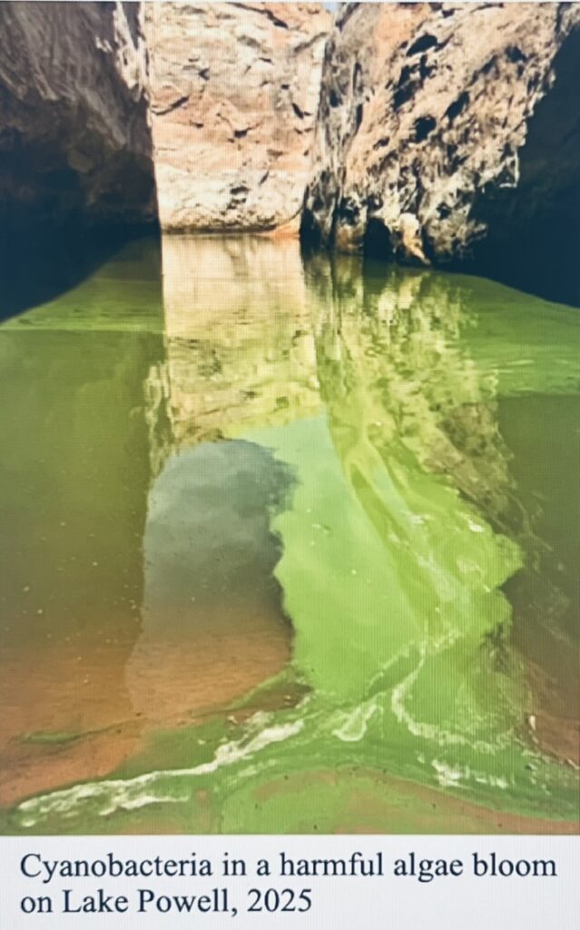
Recent water testing confirmed the presence of microcystin, a dangerous cyanotoxin produced by harmful algal blooms, within Antelope Canyon. Park scientists reported that raw water samples drawn directly from floating algal masses exceeded 10 parts per billion, the maximum detection limit of the park’s testing equipment.
When those samples were mixed to replicate typical recreational conditions, toxin levels registered at approximately 7.5 parts per billion. The U.S. Environmental Protection Agency sets the human health safety threshold for swimming at 8 parts per billion. Park officials warned that the microcystin levels are hovering near or above unsafe limits, making contact with visible algae a significant health hazard.
Harmful algal blooms occur when naturally occurring blue-green algae multiply rapidly in warm, calm, and shallow waters. High summer temperatures combined with nitrogen and phosphorus carried into the lake by monsoonal stormwater runoff create ideal conditions for the toxic colonies to thrive.
Visitors are urged to scan the water before entering and avoid any areas displaying a pale-green or pea-green scum on or just below the surface.
Rising E. Coli and Contamination Risks
Park officials also warned of elevated Escherichia coli bacteria counts across multiple areas of Lake Powell, Lees Ferry, and various Colorado River tributaries. A combination of changing environmental factors and human behavior is driving the bacterial risk.
Fluctuating reservoir levels play a major role, as rising waters lift and dissolve previously deposited human, pet, and livestock waste along the shoreline. Intense monsoonal storms sweeping across the surrounding plateaus also wash wildlife and agricultural waste down the canyons directly into the reservoir.
The risk is highest at heavily visited houseboat sites and accessible shoreline beaches where some visitors fail to use portable toilets or approved waste-disposal bags. Park officials noted that illegal dumping of septic tanks from private recreational vessels continues to threaten water quality, though all rental houseboats are now equipped with mechanical systems to prevent illegal discharges.
Stagnant pools in slot canyons and shallow beach areas, cut off from the main reservoir flow, are notorious hot spots for bacteria. Because these warm, isolated pools are frequently where children prefer to play, officials urged parents to steer children away from standing water.
Recreational Water Illnesses
The National Park Service detailed several pathogens currently threatening swimmers who ingest or come into contact with contaminated water.
Gastrointestinal illnesses represent the primary threat. Cryptosporidium, a chlorine-resistant parasite found in fecal matter, is a leading cause of water-borne diarrhea. Giardia, frequently carried by local beaver populations, and highly contagious noroviruses are also present. Infections from E. coli and Shigella can cause severe diarrhea and bloody stools, with E. coli posing a life-threatening risk of permanent kidney damage.
Beyond stomach illness, contaminated water can cause pseudomonas dermatitis, commonly known as hot tub rash, which produces itchy, bumpy skin reactions. Swimmer’s itch, an allergic reaction caused by microscopic parasites leaving infected lake snails, can occur if swimmers do not dry off immediately after exiting the water.
Officials also issued warnings about respiratory illnesses such as legionellosis, or Legionnaires’ disease. Activities such as motorboating, water skiing, or jet skiing over scummy water can aerosolize cyanotoxins and bacteria into a fine mist. Breathing in this contaminated vapor can cause serious lung infections or life-threatening pneumonia.
Safety Recommendations for Visitors
The National Park Service stated that no additional recreation restrictions or closures are in effect. Boating, kayaking, fishing, and hiking remain entirely unaffected as long as visitors avoid visible algae.
To prevent illness, park authorities released a set of basic hygiene mandates for all beachgoers. Visitors must never ingest lake water and should wash their hands thoroughly before eating, touching their eyes, or touching their mouths. Everyone should shower with soap immediately after swimming or handling water gear and fishing equipment.
Individuals with open sores, cuts, or active symptoms of diarrhea are instructed to stay out of the water completely to protect themselves and prevent spreading pathogens to others.
Pets and livestock face severe poisoning risks from cyanotoxins. Owners must keep animals away from any water showing signs of algae and rinse them immediately with clean water if accidental contact occurs so they do not lick the toxins from their fur.
The park is requesting assistance from the public to monitor the changing conditions. Visitors who spot potential harmful algal blooms are asked to email photographs and GPS coordinates to glca_information@nps.gov.
For medical or environmental emergencies on Lake Powell, visitors should call 911 or hail the National Park Service directly on Marine Band 16.cSource: Lake Powell Chronical, July 6, 2026
6. Best Way To Wash Your Fruits And Vegetables Of Toxins Before Eating. Source: EWG
Using tap water
Hold the produce under running water, rubbing and rotating it with your hands gently. For firmer items, like potatoes or carrots, you can use a produce brush.
Rinse for at least 20 seconds.
Soaking in tap water
Fill a large bowl or clean sink with tap water.
Soak produce for 10-15 minutes.
Take the produce out of the water rather than pour it out, so dirt can settle to the bottom.
Rinse under water to remove any remainingresidue on the surface.
Soaking in baking soda OR food-grade vinegar, such as distilled white vinegar
In a large bowl or basin, mix a teaspoon of baking soda for each cup of water or mix 1 part vinegar to 3 parts water.

Soak produce for 5-10 minutes.
Take the produce out of the soaking water rather than pour it out, so dirt can settle to the bottom. Rinse under running water to remove any remaining sediment and baking soda and vinegar on the surface.
Copyright 2026@ EnviroInsight.org
