Daniel Salzler No. 1306 EnviroInsight.org Three Items May 16, 2025
—————Feel Free To Pass This Along To Others——————
If your watershed is doing something you would like others to know about, or you know of something others can benefit from, let me know and I will place it in this Information .
If you want to be removed from the distribution list, please let me know.
Please note that all meetings listed are open.
Enhance your viewing by downloading the pdf file to view photos, etc.
The attached is all about improving life in the watershed through knowledge.
If you want to be removed from the distribution list,
please let me know. Please note that all meetings listed are open.
Check our website at EnviroInsight.org
1. CAP University June 24 from 9 a.m. to 11 a.m.
CAP 101

How much do you know about the large canal that brings water across Arizona to Maricopa, Pima, and Pinal counties where more than 80% of the state’s population lives? Do you know how it works? Where the water comes from? How Colorado River reductions impact Arizona, and what the future holds?
If you’d like to learn more, here’s your chance.
CAP University is a program to increase awareness and knowledge about CAP. Sign up today for our Introduction to CAP course.
Register here and you’ll receive a link to sign-in on the day of the event.
To register: https://www.eventbrite.com/e/cap-university-cap-101-tickets-1343046832229
2. The Drought Interagency Coordinating Group (ICG) is an advisory body to the Governor on Arizona drought issues.
The Spring 2025 Drought Interagency Coordinating Group (ICG) Meeting is scheduled for Tuesday, May 20, 2025, at 10:00 am-12:00 pm MST (Phoenix time).
The meeting will be held in-person with a virtual option (hybrid), at the Arizona Department of Water Resources (1110 W. Washington St. Ste. 310, Phoenix, AZ 85007), in the Thunder River Conference Room.
You may access the virtual option here. [https://azwater.webex.com/wbxmjs/joinservice/sites/azwater/meeting/download/d27b857fa0944f3ab435e921e1dcb05e?siteurl=azwater&MTID=macfab70ecdaf2e5eb6464ca83df63bf3]
Based on the presentations and discussion, the ICG will be asked to make a recommendation to the Governor about whether to maintain the Drought Declarations (PCA 99006 and EO 2007-10) currently in place.
3. Taking A Tour With SRP To See The Reality Of Arizona’s Water Storage
Despite what we often hear, Arizona is not in a water crisis? The more accurate term would be a persistent “water challenge.”
It’s the desert. We go through droughts. We have for thousands of years.
The key to ensuring our water supply is capturing as much water as we can during wet years, which are less frequent.
Here in the Valley, we capture water exceptionally well.
Come along as we take a tour of Arizona’s lakes and dams with the Salt River Project (SRP).
By the numbers:
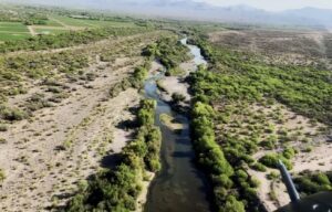
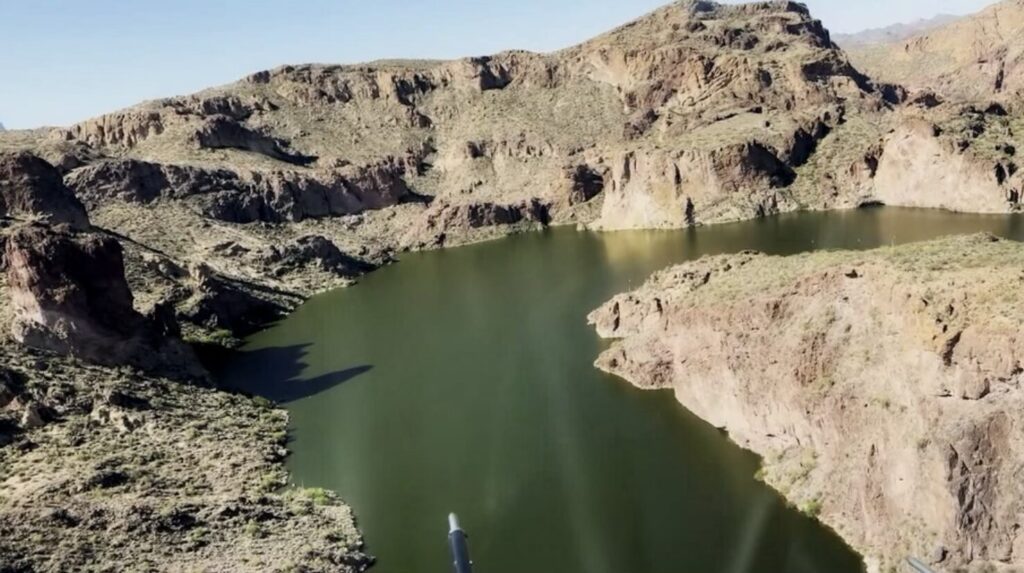
We took a trip up the Verde River – a trickle in the spring due to a dry winter.
The SRP watershed covers 13,000 square miles.
As rain and snow fall, the plants and soil soak up nearly all of it. We only capture 1.12%.
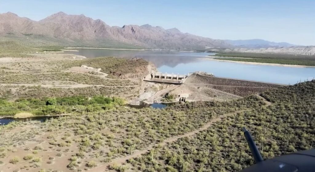
Let’s begin at the top of the Verde – Horseshoe Lake and Horseshoe Dam – named for its shape. They’re at 62% capacity.
Horseshoe Lake and Horseshoe Dam
To the south, Bartlett Lake and dam, 48% full.
There’s a plan to raise the dam wall a hundred feet. If approved, it would triple capacity.
The Verde River system provides our water in the fall and winter.
Flying east across the Mazatzal Wilderness to the Salt River chain, which provides water in the spring and summer.
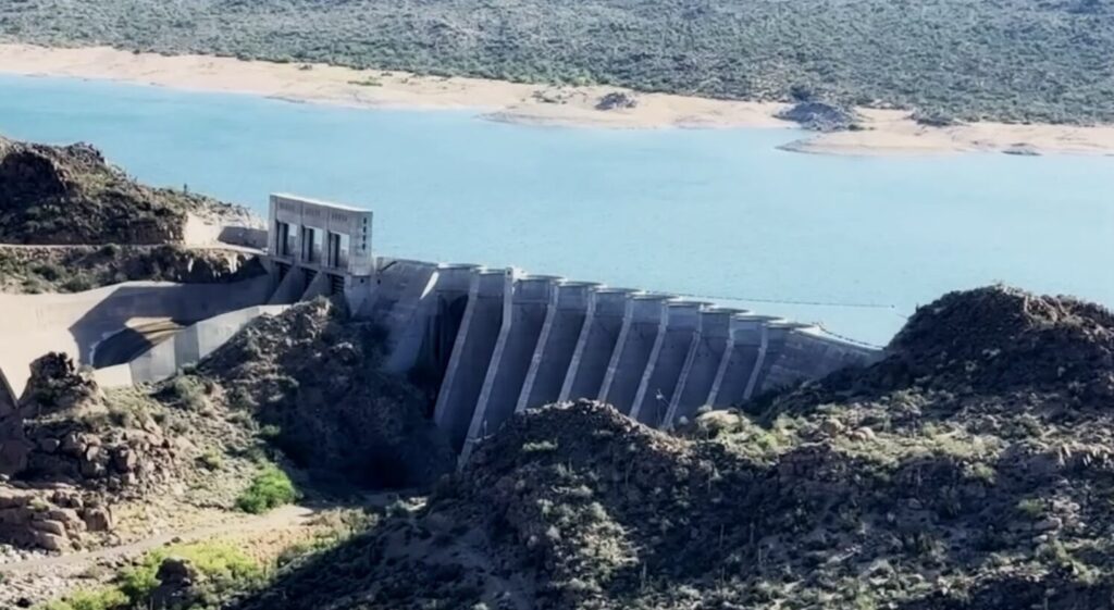
Roosevelt Lake
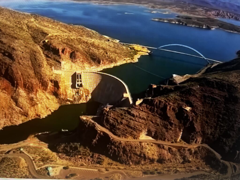
Roosevelt Lake, which was formed by the Roosevelt Dam completed in 1911. It’s the largest lake in the chain by far.
It accounts for 70% of SRP’s reservoir storage.
In the 1990s, the dam was raised 77 feet, more than doubling its capacity. It also provides hydroelectric power to the Valley.
“As you can tell, these reservoirs are almost entirely full
Roosevelt is called the dam that helped tame the Salt River, but it presents a challenge.
“In all of our reservoir operations, our mantra is, ‘we plan for dought, but prepare for floods,’” SRP hydrologist Jacob Richardson said.
We’ve had plenty of floods around Arizona. 1970, 1980, 1993.
Sometimes, there’s just too much water. More often than not, the mission is to store more.
Apache Lake
Five miles downstream on the Salt River, Apache Lake. It’s a magnificent body of water framed by picturesque canyons.
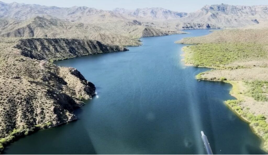
It’s dotted with cave dwellings dating back 800 years.
Apache Lake is formed by Horse Mesa Dam – the second-largest reservoir on the Salt River – which is 95% full.
“We don’t maintain a flood control pool in any of these reservoirs. That is, again, to maximize the amount of potential energy stored within the water as we release it through the dams to generate electricity,” Richardson explained.
Like Roosevelt, it serves a dual purpose. Water storage and energy production.
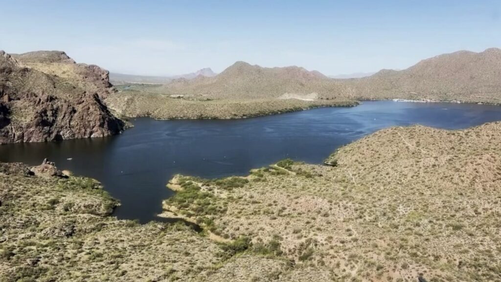
Canyon Lake
45 minutes east of Phoenix is Canyon Lake, which is 94% full.
It was formed by Mormon Flat Dam, named after early Mormon settlers, completed in 1926. It also provides hydropower to the Valley.
Sagauro Lake
The final link in the Salt River chain is Saguaro Lake, which was formed by Stewart Mountain Dam. Completed in 1928, it’s currently at 92%.
It also serves several purposes, like water storage, flood control and hydroelectric power.
Granite Reef Dam
Finally, the end of the line, Granite Reef Dam, which was completed in 1908. It’s where the Verde and Salt rivers merge along with the Central Arizona Project (CAP), delivering Colorado River water.
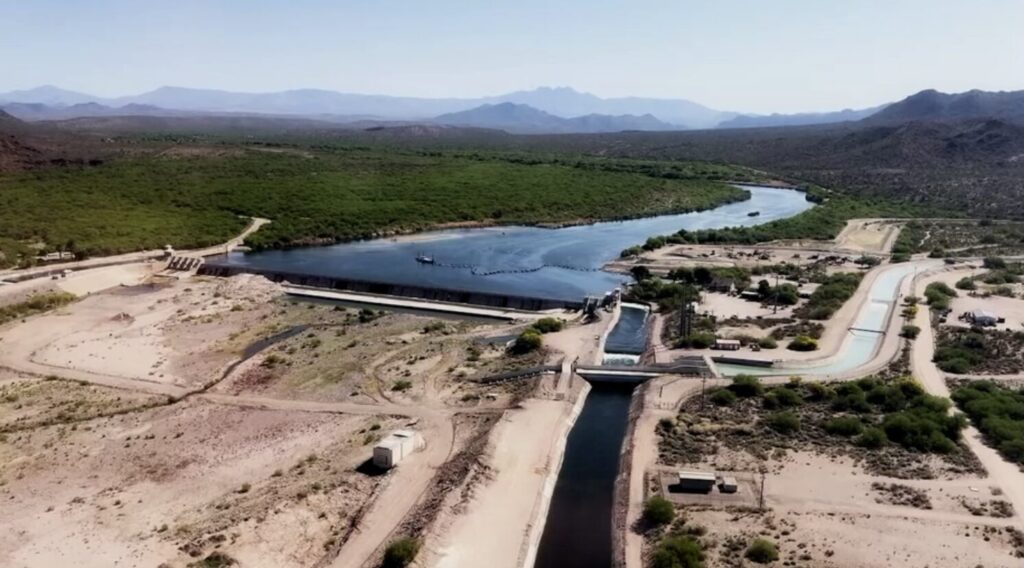
Granite Reef Dam was built to control flooding and divert water into the labyrinth of canals that deliver much of the Valley’s water.
Farm land uses much of the state’s water
Agriculture uses 74% of Arizona’s water.
“They are just as much concerned about efficient water use as anybody because they understand that that’s their livelihood. Without the water, they can’t grow,” Richardson explained.
Looking Ahead:
Because of Arizona’s explosive growth over the years, we have traded water-intensive farm land for subdivisions, which use far less water.
Because of that, Arizona actually uses less water than we did in 1957, despite adding six million more people. Source: SRP
Copyright 2025: EnviroInsight.org