Daniel Salzler No. 1343
EnviroInsight.org Five Items January 30, 2026
—————Feel Free To Pass This Along To Others——————
If your watershed is doing something you would like others to know about, or you know
of something others can benefit from, let me know and I will place it in this Information .
If you want to be removed from the distribution list, please let me know.
Please note that all meetings listed are open.
Enhance your viewing by downloading the pdf file to view photos, etc.
The attached is all about improving life in the watershed through knowledge.
If you want to be removed from the distribution list,
please let me know. Please note that all meetings listed are open.
Check our website at EnviroInsight.org
1. It’s the Water-Saving Event of the Year! Join us in-person on Saturday, February 28, 2026, from 8 a.m. – noon at PERA Training and Conference Center in Tempe for the water-saving event of the year! The annual SRP Water Conservation Expo brings together our community to raise awareness of water in the Valley and discover ways to conserve at home.
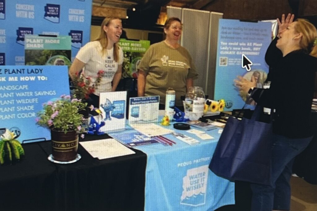
Visit the Water – Use It Wisely booth for water-wise landscaping inspiration, expert tips, and a chance to win amazing prizes!
Purchase a smart irrigation controller (limit 1) for $60 plus tax, spray heads (limit 20) for $2.50 plus tax, and nozzles (limit 20) for $.50 plus tax.
Shop local vendors and more at the community market.
2. ASU, SRP Project Takes Flight To Improve Water Supply Forecasting. A high-tech airplane combined with innovative modeling will measure snowpack and snowmelt, providing critical data for better water management.
Arizona State University and Salt River Project are working with Airborne Snow Observatories Inc. on an innovative project to measure snowpack in the Salt River watershed — providing crucial data to improve water management.
For the first time, a collaborative research team is using an airplane equipped with state-of-the-art scanning lidar and imaging spectrometers, along with innovative computational modeling from ASU, to measure snowpack and determine how much water it contains. The NASA Jet Propulsion Laboratory developed the airborne technology.
The data collected during the flights will be analyzed and used to test hydrologic forecasting models developed by ASU Professor Enrique Vivoni with the School of Sustainable Engineering and the Built Environment. Vivoni is the primary investigator for the joint project.

“Mapping snow cover with these airborne technologies is a first of its kind for the state of Arizona,” said Vivoni, also with the Arizona Water Innovation Initiative in the Julie Ann Wrigley Global Futures Laboratory. “We are excited about using snow maps in forested regions of the Salt River to improve runoff forecasts and train algorithms that apply artificial intelligence.”
The study’s findings will help SRP more accurately forecast runoff into the seven reservoirs that supply water to more than 2.5 million Valley residents.
The ASO Inc. flights will focus on the basin areas upstream of the Roosevelt Dam on the Salt River in the Upper Black River Basin area near New Mexico. A pilot and scientist on board will fly across the entirety of the basin several times during four- to five-hour flights, gathering data on snow conditions. Depending on weather, three flights are scheduled through March with the first leaving Safford, Arizona, on Jan. 21.
SRP uses a variety of tools to measure snow water equivalent across the watershed to manage the 260 billion gallons of water delivered annually to the Valley. The SRP watershed has historically been challenging to measure precipitation and runoff due to rapidly changing snowpack conditions in the forested regions.
“This project is so critical because it will enable SRP to strengthen our measurement tools and provide more accurate data as we manage the reservoirs,” said Bo Svoma, SRP climate scientist and senior meteorologist.
An SRP snow survey occurring on the same days will provide additional information to complement the data gathered from the ASO flights. SRP crews will be on the ground measuring the snow water equivalent and depth, and flying over snow markers to estimate depth at many locations. Source: https://news.asu.edu/20260121-environment-and-sustainability-asu-srp-project-takes-flight-improve-water-supply
Learn about water conservation products and rebate programs. Attend free smart irrigation controller and water-related classes taught by experts.
Visit srp.net/2026expo to learn more and register!
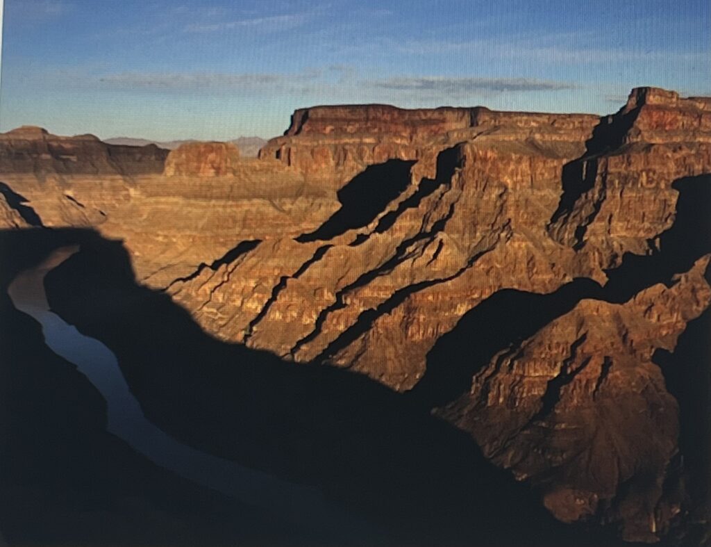
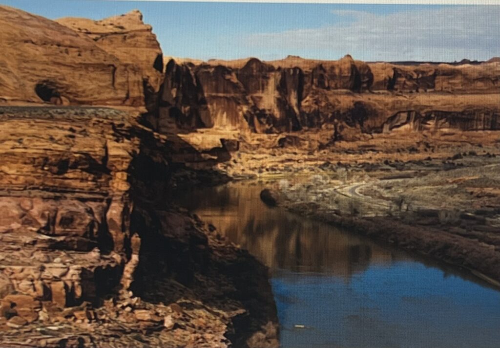
3. No Colorado River Deal In Sight, Arizona’s Water Chief Says. The federal government may have to impose a Colorado River management plan on the seven river basin states because of their lack of progress toward reaching their own agreement, Arizona’s water chief says.
Four days of negotiations in the past week brought the states no closer to agreeing on the major issues dividing them, said Tom Buschatzke, director of the Arizona Department of Water Resources. He and other states’ water officials met in Salt Lake City in their latest of many meetings over the past two years.
But in a news briefing Friday, Buschatzke held out hope the river’s Lower and Upper Basin states will stand a better chance of finding common ground when they meet in Washington, D.C., at the end of January, along with the governors of their states. He and Arizona Gov. Katie Hobbs have been pushing for such a meeting since late last year.
“I have a (plane) ticket and a hotel room” for the upcoming meeting, Buschatzke said.
The states are trying to meet a federally imposed deadline of Feb. 14 to agree on a water-saving plan. Then, the U.S. Bureau of Reclamation, which runs the seven-state talks, wants to get a final plan wrapped up and approved to replace the current plan of river operations when it expires at the end of 2026.
The two basins are at odds over three main points, Buschatzke said Friday, in the first detailed account of the negotiations he has provided in a long time.
Among the points of contention is how much water the Upper Basin states will release downstream from Lake Powell to Lake Mead — which determines how much water Arizona and the other two Lower Basin states, California and Nevada, will be able to take from the river in a given year.
The Upper Basin states are New Mexico, Colorado, Utah and Wyoming.
Also at issue is how much water will be released from reservoirs upstream of Lake Powell, such as the Flaming Gorge reservoir at the Wyoming- Utah border, to help prop up Lake Powell if it falls too close to critically low levels that would lower its releases to Lake Mead.
Also, the Upper Basin states have repeatedly declined to offer any mandatory, legally enforceable program to reduce their water use, despite repeated demands from Buschatzke and other Lower Basin state water leaders to do so.
Buschatzke said he believes the states still hope to avoid litigation, which would delay, possibly for years, putting into place any kind of fix for the river while its flows and reservoirs keep declining.
The Star reached out Friday to a spokeswoman for Becky Mitchell, Colorado’s Colorado River commissioner, and Gene Shawcroft, Utah’s commissioner, for comment on Buschatzke’s remarks, and got no immediate response. Chuck Cullom, the Upper Colorado River Commission’s executive director, also didn’t respond to a request for comment.
J.B. Hamby, California’s Colorado River commissioner, texted in response to the Star’s request for comment, “Nothing to share for now.”
Buschatzke was asked about one of the bureau’s alternatives in its environmental report that calls for slashing river water use by up to 4 million acre-feet a year. That’s more than four times the amount of river water that the Central Arizona Project delivers annually to cities and farms in the Tucson and Phoenix areas.
If that were to happen and the Lower Basin had to take all the cuts as Upper basin states have advocated, that could cause major hardships in Arizona, Nevada and California, he said.
Government officials would have to decide what uses of water are essential for public health and safety and thereby warrant getting river water in the event of that big a shortage, he said.
But he hopes that if the river ever dries up enough to require a 4 million acre-foot cut, it will be implemented gradually rather than all at once, he said.
Even if the 4 million in cuts were split 50-50 between the two basins, the Upper Basin would have a tough time trimming its use by 2 million-acre feet, he said. That’s because the four Upper Basin states typically use only 4.5 million acre-feet of river water annually, compared to roughly 7 million for the Lower Basin states and Mexico, he said.
The federal government may have to impose a Colorado River management plan on the seven river basin states because of their lack of progress toward reaching their own agreement, Arizona’s water chief says.
Four days of negotiations in the past week brought the states no closer to agreeing on the major issues dividing them, said Tom Buschatzke, director of the Arizona Department of Water Resources. He and other states’ water officials met in Salt Lake City in their latest of many meetings over the past two years.
But in a news briefing Friday, Buschatzke held out hope the river’s Lower and Upper Basin states will stand a better chance of finding common ground when they meet in Washington, D.C., at the end of January, along with the governors of their states. He and Arizona Gov. Katie Hobbs have been pushing for such a meeting since late last year.
“I have a (plane) ticket and a hotel room” for the upcoming meeting, Buschatzke said.
The states are trying to meet a federally imposed deadline of Feb. 14 to agree on a water-saving plan. Then, the U.S. Bureau of Reclamation, which runs the seven-state talks, wants to get a final plan wrapped up and approved to replace the current plan of river operations when it expires at the end of 2026.
The two basins are at odds over three main points, Buschatzke said Friday, in the first detailed account of the negotiations he has provided in a long time.
Among the points of contention is how much water the Upper Basin states will release downstream from Lake Powell to Lake Mead — which determines how much water Arizona and the other two Lower Basin states, California and Nevada, will be able to take from the river in a given year.
The Upper Basin states are New Mexico, Colorado, Utah and Wyoming.
Also at issue is how much water will be released from reservoirs upstream of Lake Powell, such as the Flaming Gorge reservoir at the Wyoming- Utah border, to help prop up Lake Powell if it falls too close to critically low levels that would lower its releases to Lake Mead.
Also, the Upper Basin states have repeatedly declined to offer any mandatory, legally enforceable program to reduce their water use, despite repeated demands from Buschatzke and other Lower Basin state water leaders to do so.
Buschatzke said he believes the states still hope to avoid litigation, which would delay, possibly for years, putting into place any kind of fix for the river while its flows and reservoirs keep declining.
Buschatzke was asked about one of the bureau’s alternatives in its environmental report that calls for slashing river water use by up to 4 million acre-feet a year. That’s more than four times the amount of river water that the Central Arizona Project delivers annually to cities and farms in the Tucson and Phoenix areas.
If that were to happen and the Lower Basin had to take all the cuts as Upper basin states have advocated, that could cause major hardships in Arizona, Nevada and California, he said.
Government officials would have to decide what uses of water are essential for public health and safety and thereby warrant getting river water in the event of that big a shortage, he said.
“Would that mean enough water for drinking and bathing? Or enough for firefighting?” he asked.
But he hopes that if the river ever dries up enough to require a 4 million acre-foot cut, it will be implemented gradually rather than all at once, he said.
Even if the 4 million in cuts were split 50-50 between the two basins, the Upper Basin would have a tough time trimming its use by 2 million-acre feet, he said. That’s because the four Upper Basin states typically use only 4.5 million acre-feet of river water annually, compared to roughly 7 million for the Lower Basin states and Mexico, he said. Source: HavasuNews.com https://www.havasunews.com/no-colorado-river-deal-in-sight-arizonas-water-chief-says/article_8ffc1d08-6690-420d-9cb9-0e4001bf591e.html
4. Hidden “Forever Chemicals’ In Popular High-End Smartwatch And Fitness Tracker Bands. New University of Notre Dame research reveals a hidden concern: The wristbands on these popular products might expose wearers to the harmful “forever chemicals” known as PFAS.
Many high-end smartwatch bands are made with fluoroelastomer, a material prized for its strength, flexibility and resistance to sweat – perfect for everyday wear. But products made with this material contain toxic PFAS, known to harm health.
While forever chemicals are prized for their durability and water resistance, their widespread presence in consumer products is causing growing unease. PFAS persist in the environment, and some accumulate over time in the body, posing long-term health risks.
The new study adds to the growing body of research revealing that PFAS are much more commonly found in a broad range of products than previously realized. And that increases the risk of greater exposure.

Researchers found the forever chemical perfluorohexanoic acid, or PFHxA, at the highest levels in the 22 fitness bands and smartwatches tested. The Environmental Protection Agency says this substance likely causes developmental, blood cell, liver and hormone harms.
Separate recent research suggests that PFAS may be absorbed by the skin. A 2024 study published in Environment International confirmed PFAS can pass through the skin and enter the bloodstream. People often wear smartwatches and fitness daily for many hours, so the question arises whether their risk goes up as a result.
PFAS contamination is a public health crisis. The chemicals are toxic at extremely low levels. Low doses are also linked to suppression of the immune system. Studies show exposure to PFAS can alsoincrease the risk of cancer,harm fetal development andreduce vaccine effectiveness.
The results of the new Notre Dame study are startling. Every fluoroelastomer band tested contained PFAS, with concentrations of PFHxA above 16,000 parts per billion, or ppb, in some samples. By comparison, when the same team tested for PFAS in cosmetics last year, the median concentration was just 200 ppb, suggesting much greater exposure from the bands.
Graham Peaslee, Ph.D., professor emeritus at Notre Dame’s Department of Physics and Astronomy, led the study’s research team.
Peaslee’s latest study also found that bands over $30 contained far higher levels of fluorine – which can indicate the presence of PFAS – than those under $15. Premium bands may therefore pose greater exposure risks, compared to more affordable alternatives. Read more at EWG’s https://www.ewg.org/news-insights/news/2024/12/hidden-forever-chemicals-popular-high-end-smartwatch-and-fitness-tracker?emci=663ce008-75f8-f011-8d4c-0022482d279b &emdi=783ce008-75f8-f011-8d4c-0022482d279b&ceid=373908
5. Ever Wonder, What Color Is the Sun? When you look up into the night sky, you see billions of stars. They appear in different colors, some cool, some hot , all temperature related.
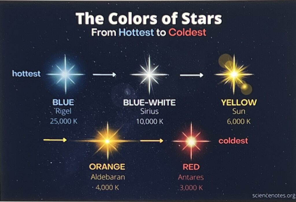
However, durring the day, our Sun is an example of a star that emits peak light in the green region of the spectrum. But, the Sun appears white as viewed from space because its apparent color is an average of all emitted wavelengths (which include red and blue). From Earth, sunlight is yellow because the atmosphere scatters blue light. Near sunrise and sunset, scattering is more pronounced and the Sun appears orange or even red.
Common formulas include: °F = (°C × 9/5) + 32 for Celsius to Fahrenheit, and K = °C + 273.15 for Celsius to Kelvin. Source: https://sciencenotes.org/the-colors-of-the-stars-from-hottest-to-coldest/
Copyright 2026@: EnviroInsight.org